
🧵Geolocations of ALL sites that the Indian Army has claimed to have hit in Pakistan and Kashmir.
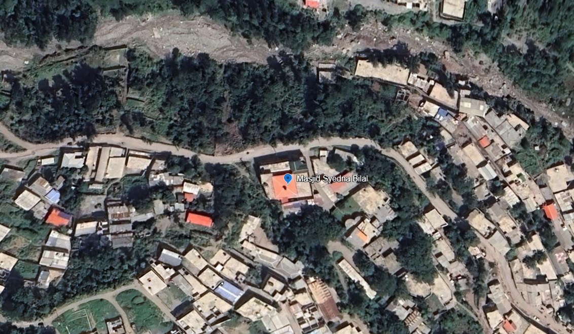
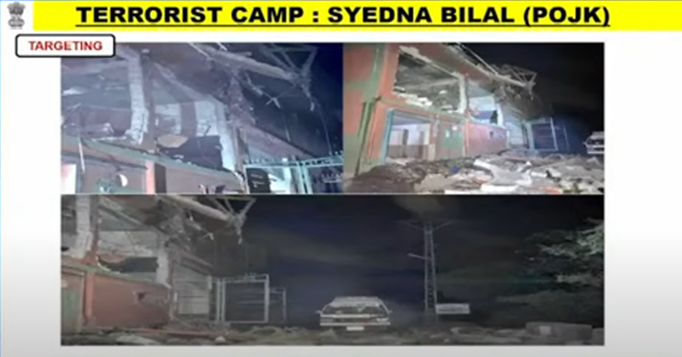
1. Masjid Syedna Bilal/Hazrat Bilal
34.385846°N 73.456974°E
It appears to have been a direct hit, according to after-strike ground photos.
https://google.com/maps/place/34%C2%B023'09.1%22N+73%C2%B027'25.1%22E/@34.3858504,73.4543991,903m/data=!3m2!1e3!4b1!4m4!3m3!8m2!3d34.385846!4d73.456974?entry=ttu&g_ep=EgoyMDI1MDUwMy4wIKXMDSoASAFQAw%3D%3D
1 / 2
Comments
33.402328°N 73.876957°E
No post-strike imagery yet.
https://google.com/maps/place/33%C2%B024'08.4%22N+73%C2%B052'37.1%22E/@33.4033345,73.8742557,2460m/data=!3m1!1e3!4m4!3m3!8m2!3d33.402328!4d73.876957?entry=ttu&g_ep=EgoyMDI1MDUwMy4wIKXMDSoASAFQAw%3D%3D
32.867802°N 74.256469°E
https://google.com/maps/place/32%C2%B052'04.1%22N+74%C2%B015'23.3%22E/@32.867748,74.2560729,276m/data=!3m1!1e3!4m4!3m3!8m2!3d32.867802!4d74.256469?entry=ttu&g_ep=EgoyMDI1MDUwMy4wIKXMDSoASAFQAw%3D%3D
Quadcopter-dropped munition appear to miss the target building and strike a courtyard around 50m away.
33.508495°N 73.906416°E
https://google.com/maps/place/33%C2%B030'30.6%22N+73%C2%B054'23.1%22E/@33.50831,73.9060043,291m/data=!3m1!1e3!4m4!3m3!8m2!3d33.508495!4d73.906416?entry=ttu&g_ep=EgoyMDI1MDUwMy4wIKXMDSoASAFQAw%3D%3D
The strike-vision provided is too distant to determine the exact impact, but no reason to think it hit anything but the target.
32.360346°N 75.124897°E
https://google.com/maps/place/32%C2%B021'37.3%22N+75%C2%B007'29.6%22E/@32.3603478,75.1238763,366m/data=!3m2!1e3!4b1!4m4!3m3!8m2!3d32.360346!4d75.124897?entry=ttu&g_ep=EgoyMDI1MDUwMy4wIKXMDSoASAFQAw%3D%3D
This location appears to be a primary health clinic. Some nationalist bloggers are claiming it was used to 'house terrorists before crossing the border'.
Idk about that, it was a health clinic.
Google calls this a Basic Health Unit site, but with no pictures or reviews. It is not listed on HDX's health-sites database or OSM. So I'm really not sure, some sources called it a 'seminary'.
31.838263°N 74.259836°E
https://google.com/maps/place/31%C2%B050'17.8%22N+74%C2%B015'35.4%22E/@31.8382675,74.2572611,929m/data=!3m2!1e3!4b1!4m4!3m3!8m2!3d31.838263!4d74.259836?entry=ttu&g_ep=EgoyMDI1MDUwMy4wIKXMDSoASAFQAw%3D%3D
The perimeter as mapped includes a hospital and several schools and colleges.
The strike imagery is distant but appears to show a pretty much a hit on the Masjid, perhaps slightly to the north-west.