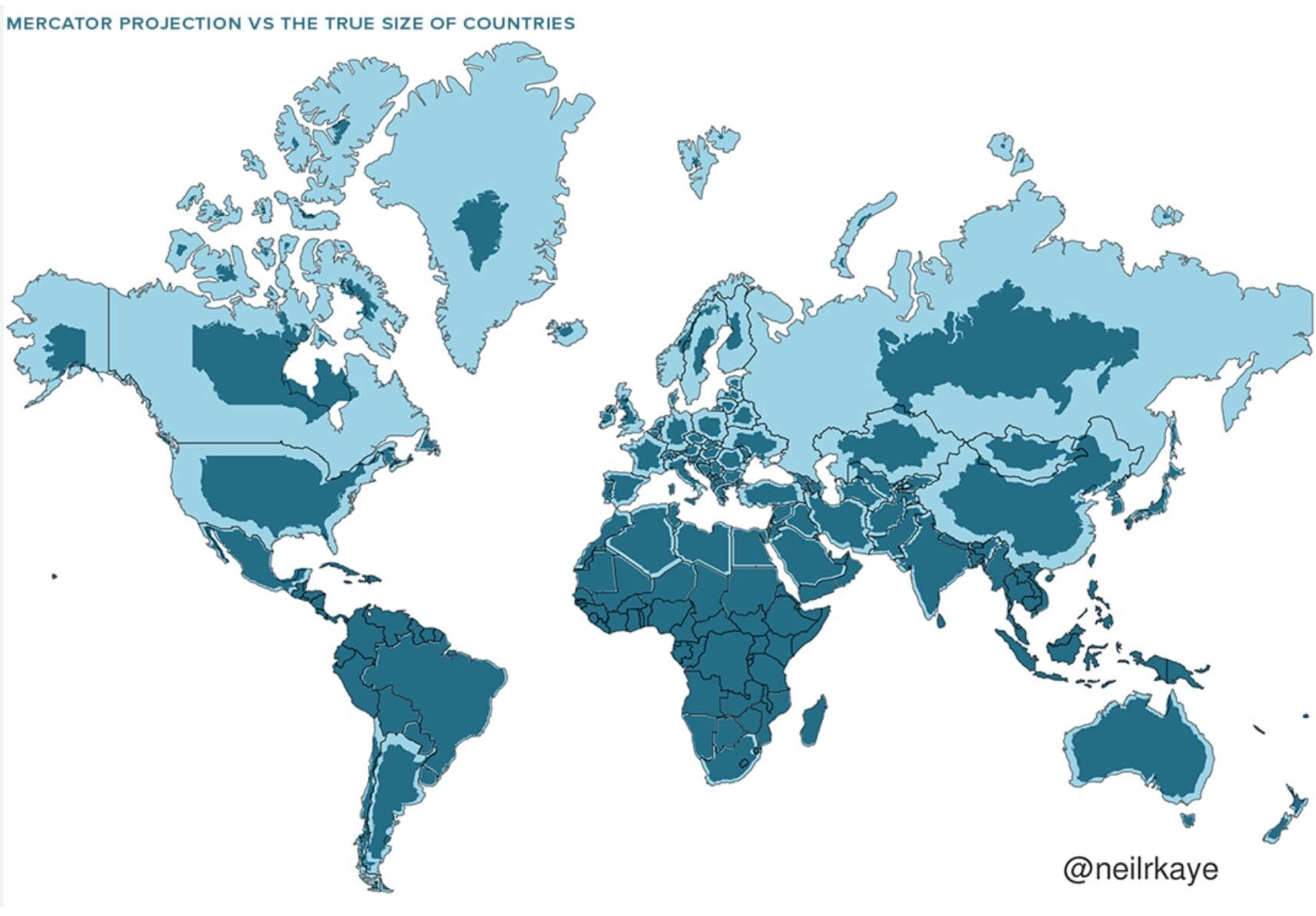
Size matters? The Mercator projection represented by in light blue, was created in 1569 by Gerardus Mercator. Adopted as the standard map for navigation in the 1700’s. The actual comparative map is the darker blue. Sorry TFG, Greenland isn’t green or larger than the US.
,
,
Comments