#30DayMapChallenge Day 6: Raster
I like grid maps for mapping tasks where landmass is not of primary importance. And a gridmap is just a coarse raster.
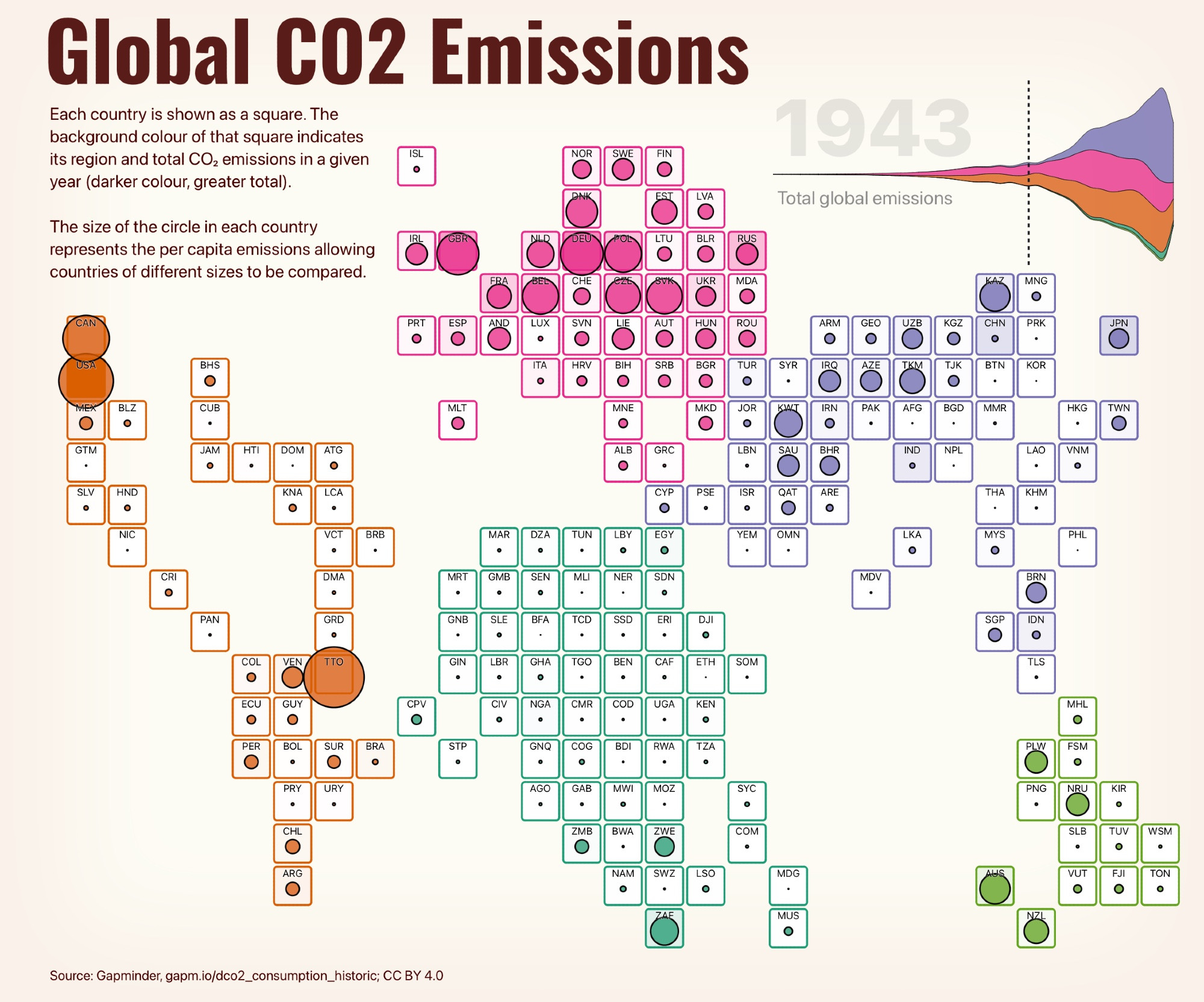
Here are C0₂ emissions since 1800. See https://observablehq.com/@jwolondon/tdmc2024_day06 for an interactive animated version to see trends over time and space.
I like grid maps for mapping tasks where landmass is not of primary importance. And a gridmap is just a coarse raster.
Here are C0₂ emissions since 1800. See https://observablehq.com/@jwolondon/tdmc2024_day06 for an interactive animated version to see trends over time and space.
Comments