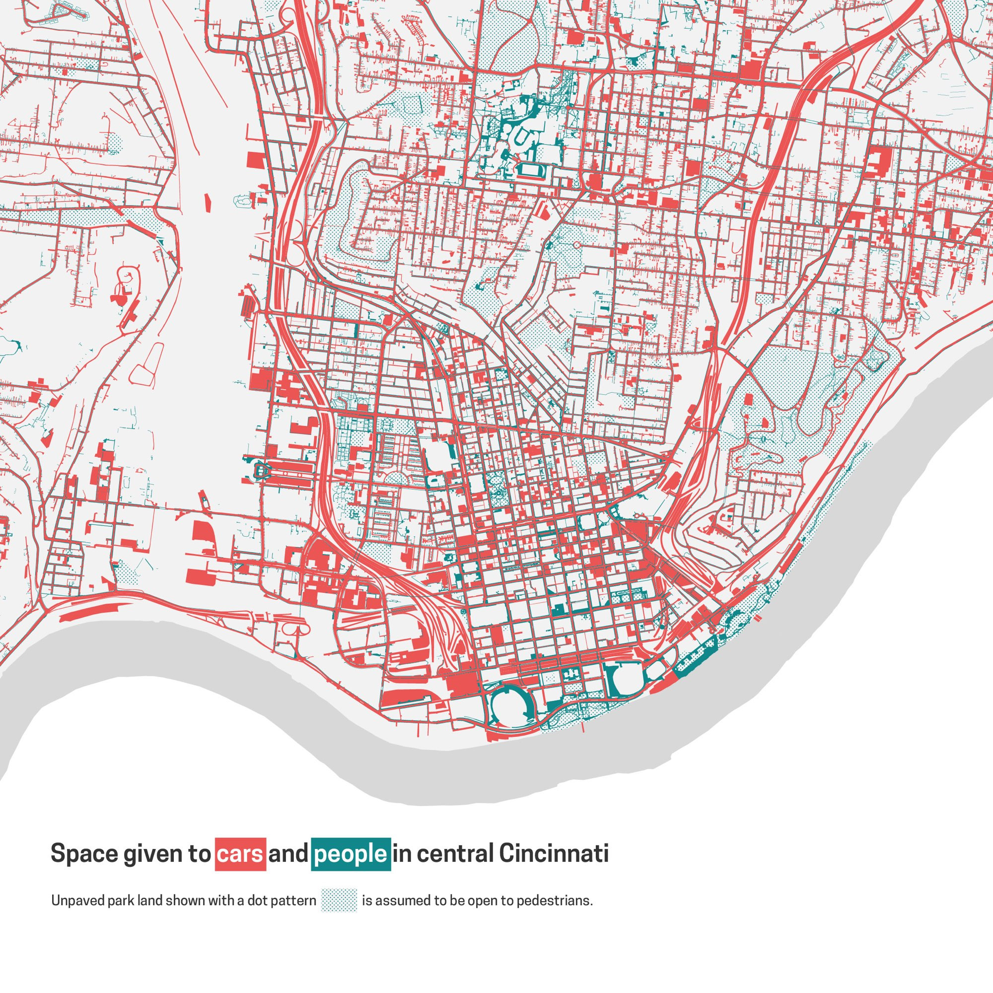
Blessings upon city and county GIS offices that make road and sidewalk polygons available, so that I can calculate just how much of a city has been sacrificed to the almighty automobile. (Looks like about 8% of Cincinnati.)
Comments
Log in with your Bluesky account to leave a comment

Comments