
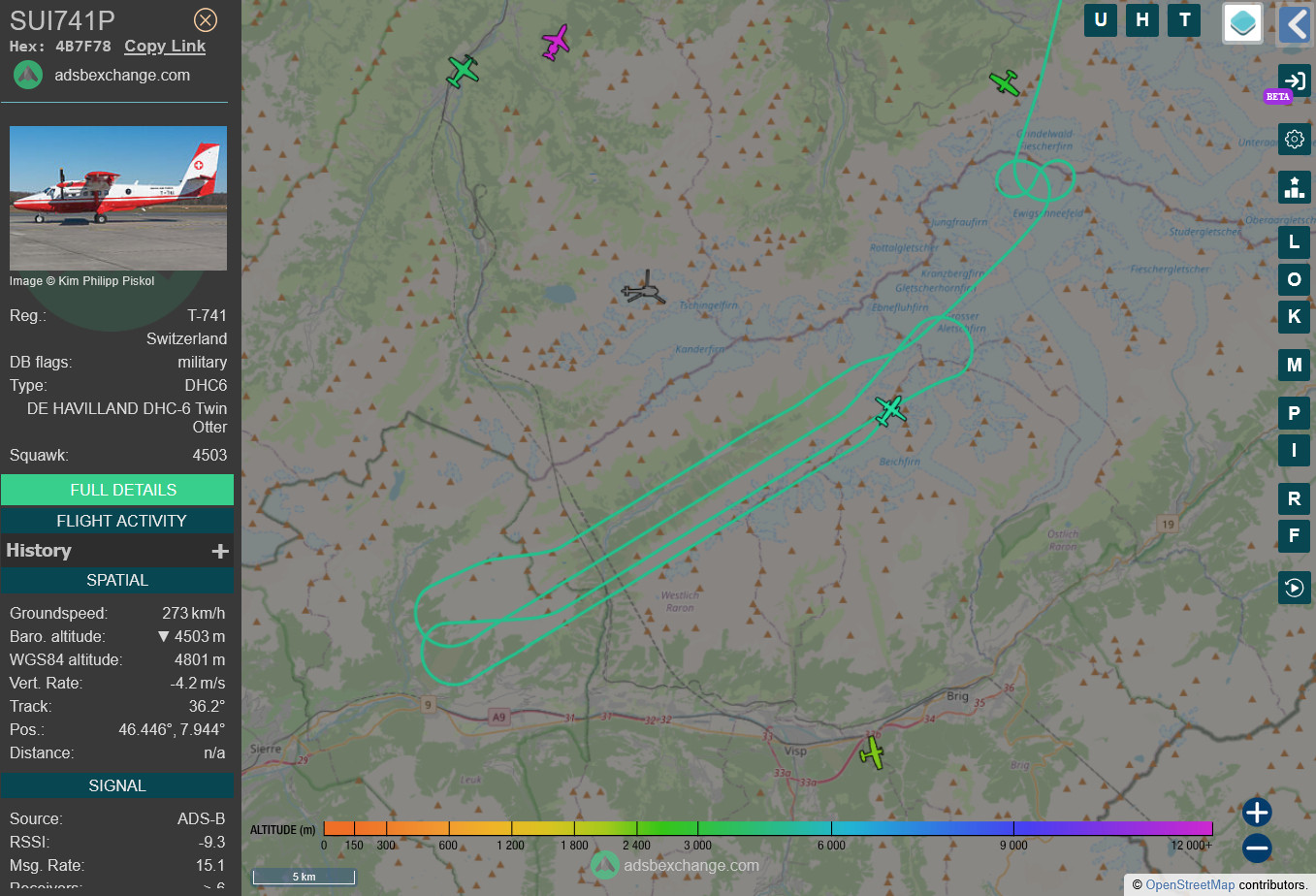
A DHC-6 Twin Otter from #swisstopo, Switzerland's national mapping agency, is currently flying a mapping pattern above the large glacier collapse in #Blatten.
This is part of the rapid mapping response for the event.
https://www.rapidmapping.admin.ch/index_en.html
(via https://globe.adsbexchange.com)
This is part of the rapid mapping response for the event.
https://www.rapidmapping.admin.ch/index_en.html
(via https://globe.adsbexchange.com)
Comments
The orthorectified images will be posted here:
https://www.rapidmapping.admin.ch/index_en.html
If they publish the oblique single images as well, I will be creating a photogrammetry reconstruction of the area.
Looking forward to seeing your photogrammetry of the area too.
https://www.geo.admin.ch/de/wms-verfuegbare-dienste-und-daten
As soon as the Swiss mapping agency will make their data available, I'll follow up with an analysis. #Blatten
Flight track via: https://globe.adsbexchange.com/?icao=4b7f78&lat=46.488&lon=7.784&zoom=10.6&showTrace=2025-05-30
More updates soon.
I assume they will post an Orthoimage from their dedicated mapping camera sooner or later. No idea if they also have a LIDAR on board, but I would assume so.