
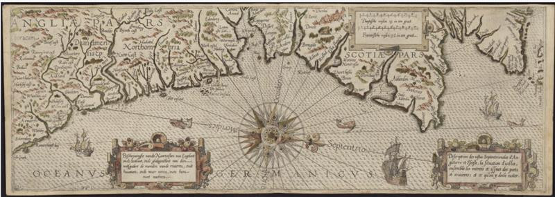
This #MapMonday, have a look at this 1592 coastal chart of the east coast of Scotland and northern England ⛵
This map was made by Dutch cartographer, Lucas Janszoon Waghenaer. Waghenaer was a skipper for 29 years. His seafaring career influenced his later work 🗺️
What familiar ports can you see? 👀
This map was made by Dutch cartographer, Lucas Janszoon Waghenaer. Waghenaer was a skipper for 29 years. His seafaring career influenced his later work 🗺️
What familiar ports can you see? 👀
Comments
Explore the map in greater detail > https://maps.nls.uk/view/216444094