
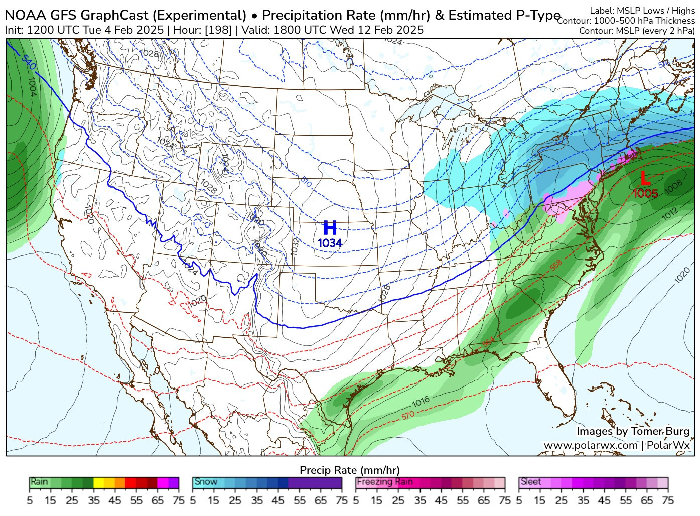
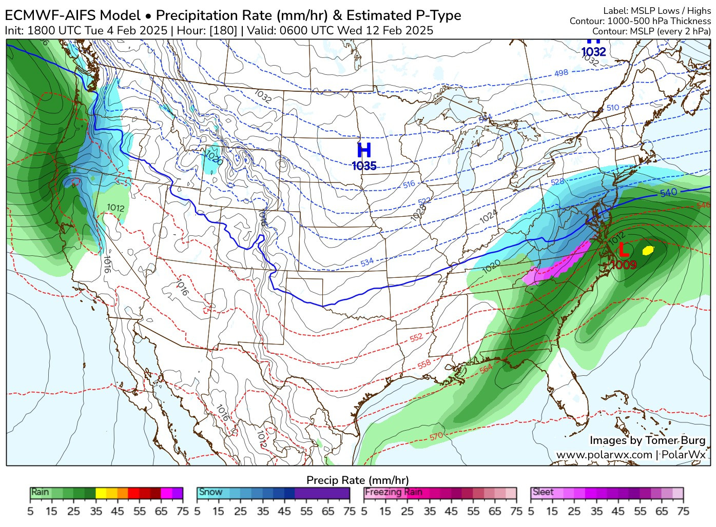
New feature for AI models (GraphCast & AIFS) on PolarWx - using the available pressure levels, these maps show the **estimated** potential precipitation type:
https://polarwx.com/models/?model=aifs&base=ptype_estimate
https://polarwx.com/models/?model=aifs&base=ptype_estimate
1 / 2
Comments
AI model output only has limited pressure level data. If there's a very shallow warm layer above freezing in between standard pressure levels (say around 800mb, or 650mb), it will be missed by this algorithm.