
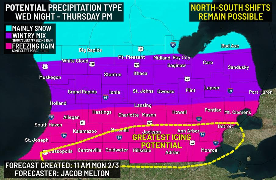
Enough consistency has appeared in computer models to allow our first forecast for potential precipitation types for the midweek storm system. Some north-south shifts remain possible as new guidance continues to come in.
Mainly snow is now anticipated from the US-10 corridor and points north.
Mainly snow is now anticipated from the US-10 corridor and points north.
Comments
Continue to monitor updates from us and your local NWS offices over the next couple of days.
#miwx #southmiwx #weather