
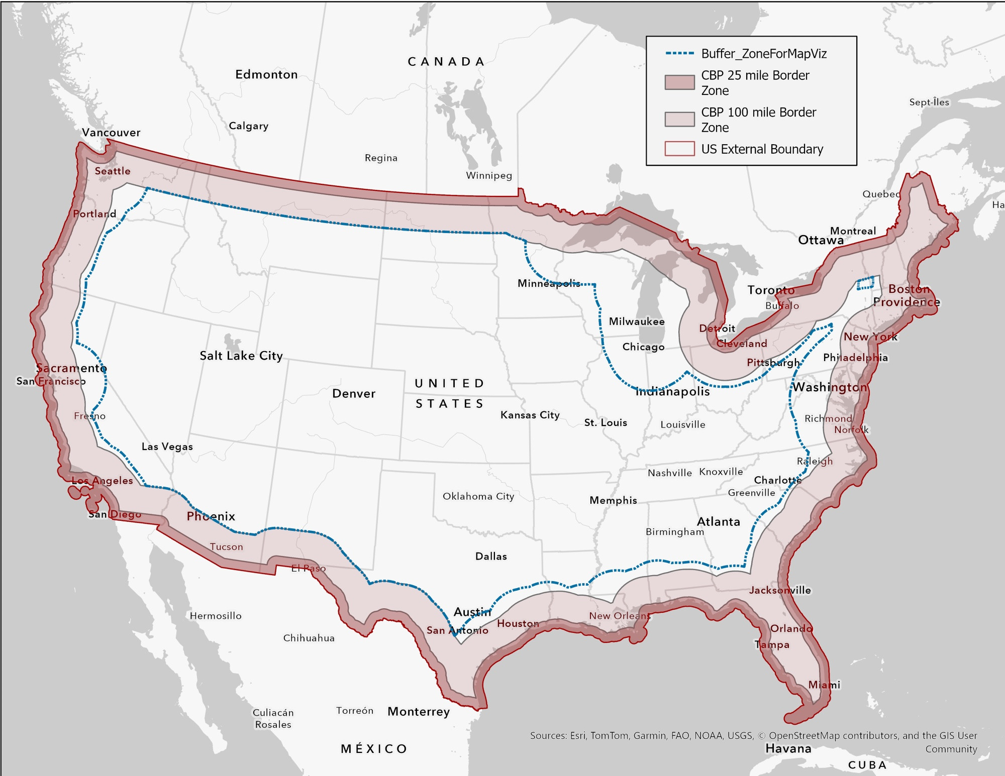
A Bloomberg article used a map that showed the Customs and Patrol 100 mile border zone based on the US coastline (blue dash). CFR 287(a) defines the 100 mile zone from the US External Boundary (I plotted in red). My map shows a much smaller zone.
https://www.bloomberg.com/news/articles/2018-05-14/mapping-who-lives-in-border-patrol-s-100-mile-zone
https://www.bloomberg.com/news/articles/2018-05-14/mapping-who-lives-in-border-patrol-s-100-mile-zone
Comments
Here is my searchable map
https://tak.maps.arcgis.com/apps/instant/basic/index.html?appid=c2e684f5f1a34bc7b1d717d9986e614d
Refs
https://www.ecfr.gov/current/title-8/chapter-I/subchapter-B/part-287/section-287.1
https://www.seacoastonline.com/story/news/crime/2018/01/27/where-is-us-water-border-depends-on-what-youre-doing/15394101007/
https://www.help.cbp.gov/s/article/Article-1253?language=en_US
https://www.aclumich.org/en/cases/all-michigan-warrantless-border-zone
https://www.aclu.org/sites/default/files/field_document/14_9_15_cbp_100-mile_rule_final.pdf
https://www.record-eagle.com/news/aclus-michigan-border-patrol-report-attracts-the-attention-of-washington-d-c/article_9f33e2ae-fad1-11eb-8f3b-ffa71cabd567.html
Shouldn’t the 100 miles start at the Delmarva ?