
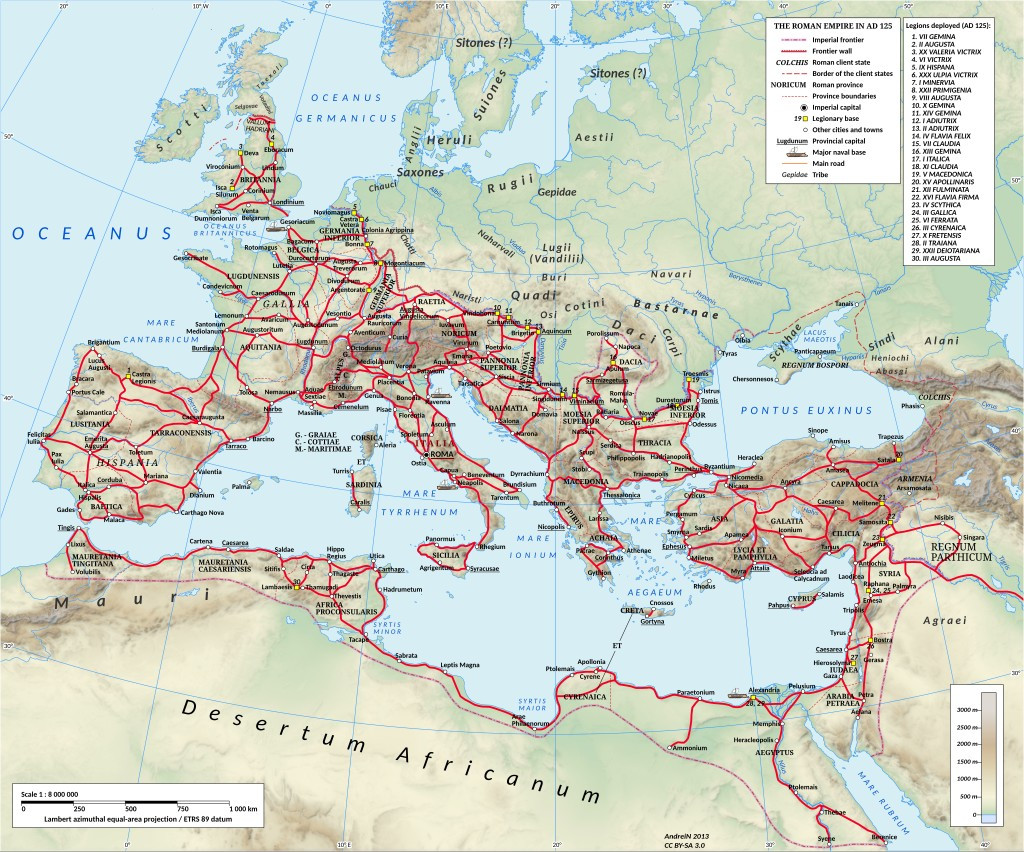
Here's a map of the Roman road network in the time of Hadrian, ~125 CE.
There were 29 military highways, 372 great roads joining 113 provinces. In total, it was more than 400,000 km of roads (250,000 miles). For comparison, the US interstate highway system is ~48,000 miles of road.
There were 29 military highways, 372 great roads joining 113 provinces. In total, it was more than 400,000 km of roads (250,000 miles). For comparison, the US interstate highway system is ~48,000 miles of road.
Comments
https://pt.wikipedia.org/wiki/Pax_Julia
Like the railroad that came after it, the series of waystations (cauponae, mansiones) created for travelers became the nucleus for thousands of new towns to form.
This is the Puente Romano, in Mérida, Spain. Built in the 1st century CE, it spans 790 meters (2600 ft).
The Romans used horses for speed/messengers, enclosed chariots (carrus) for non-riders, coaches (raeda) for groups, and ox-drawn carts (plostrum) for cargo.
Specialized engineers worked with teams of slaves or soldiers to dig trenches that would become multi-layered roads with camber to shed water, drainage ditches, and footpaths along the outside.
But the roads remain & served the civilizations that came after for many centuries to come.
It's a hell of a legacy.
This map accurately depicts Roman province, "IUDAEA", as it would have been known in 125 CE.
This is not a political statement, just accurate chronology of events.
“What did the Romans ever do for us”? …