
Hello All.
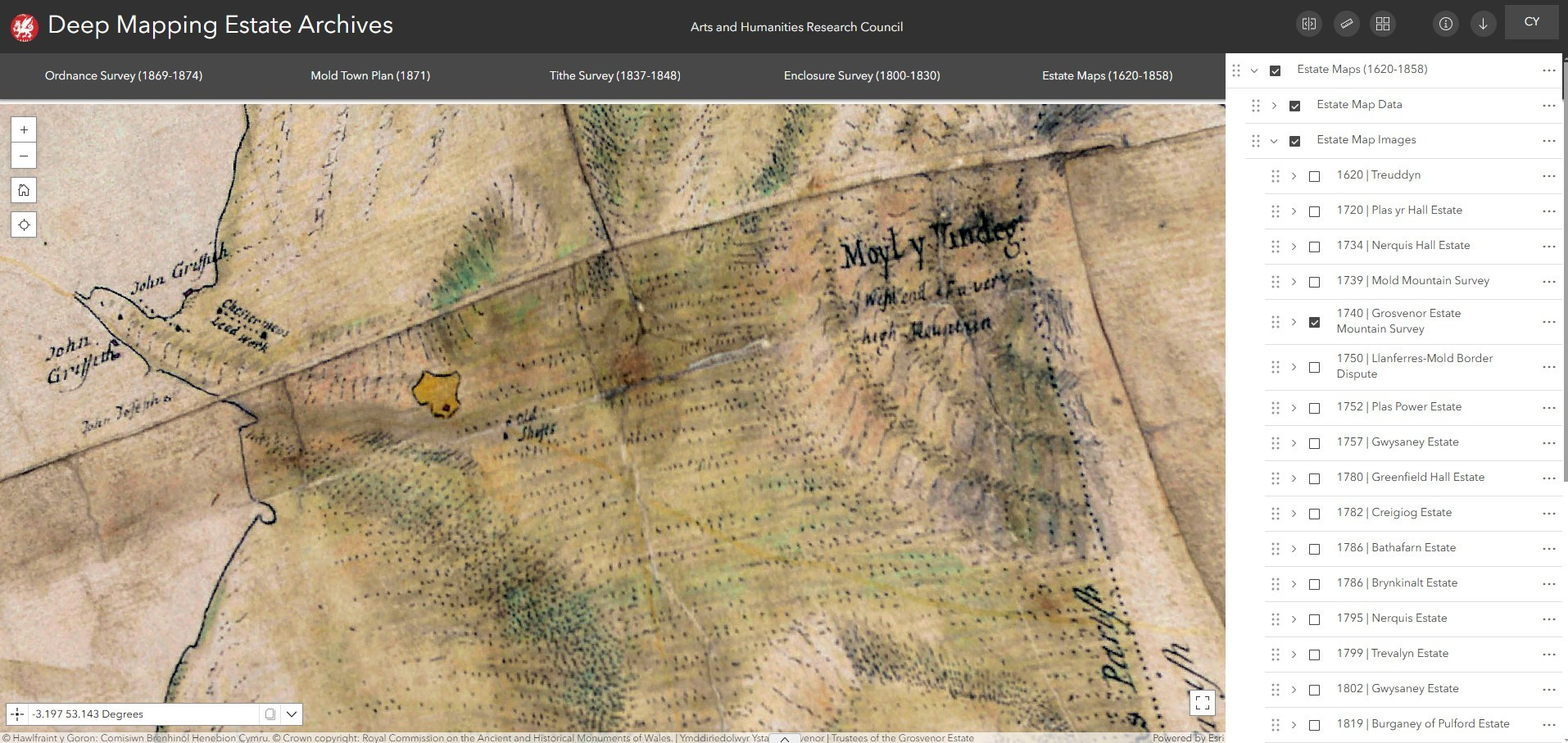
Just thought I'd share this screen shot from #DeepMappingEstateArchives webmap of the Thomas Badeslade map created in 1740 for the Duke of Westminster showing their landholdings of the uplands of Denbighshire. Love that there are 'old shafts' indicated on this map, how old are they!?
Just thought I'd share this screen shot from #DeepMappingEstateArchives webmap of the Thomas Badeslade map created in 1740 for the Duke of Westminster showing their landholdings of the uplands of Denbighshire. Love that there are 'old shafts' indicated on this map, how old are they!?
Comments