Now that @gmtgames.bsky.social has offered a "sneak peek" of the first Coast Watchers game art - the board by artist Robert Altbauer - I though I'd say a little about its design. ...
Comments
Log in with your Bluesky account to leave a comment
Here was my last homemade prototype. You can see in the version above how Robert stuck closely to the original functional elements while making it beautiful (to me, certainly!) ...
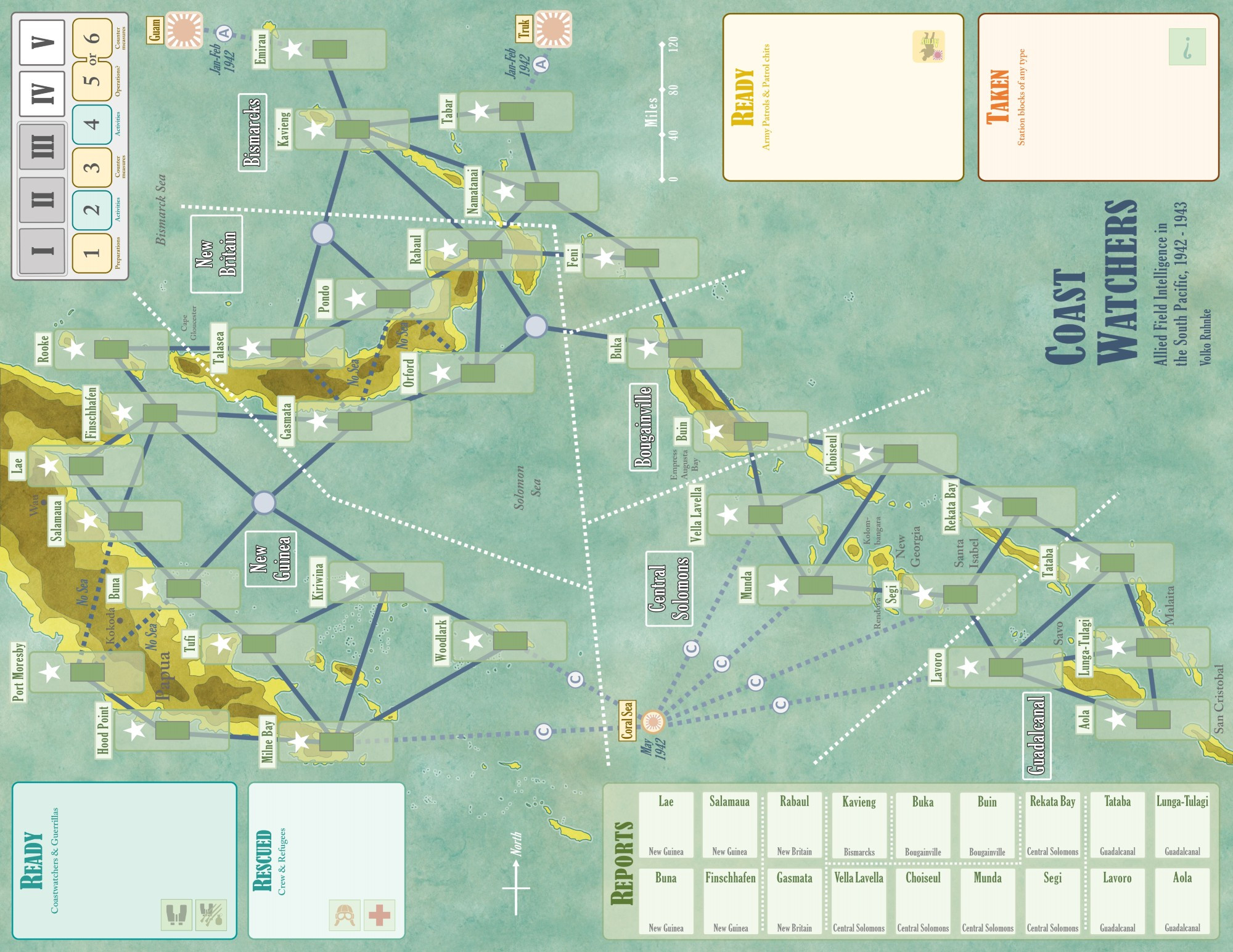
The game covers South Pacific activity from January 1942 to December 1943. In that time, Japanese forces arrived at Rabaul, reached zenith above Port Moresby and on Guadalcanal, and got forced back to their main base islands of New Britain and Bougainville. So the map had to include all that. ...
The sweeping Japanese and Allied military are just context for the intelligence game in Coast Watchers, however. What really matters is the network of coastwatching Stations shown on the game map. The game features 32 historical stations - not the complete list, but representative. ...
In the game, Coastwatching stations - perhaps active, perhaps not - will seek to observe and warn of Japanese military activity. The Japanese (typically) will launch air & sea operations seeking to bypass active stations. So it is the network as a whole that matters most.
In this compatibility test (new map art with homemade bits), you spot that many stations are inactive (palms) while other have coastwatchers (binoculars) or other personnel.
Proximity of coastwatching stations matters, for delivery range of personnel or resupply delivery, for sending out spies, and for the routes that the Japanese will fly or sail. Various special connections, like "No Sea", modify use.
I was thinking the new art looked pretty similar to the playtest map, but Robert’s work is very evident when seen side by side. Love the topo feel of the land masses, and the overall impression of an aged nautical chart. I wonder if the large white boxes can be given a slight tint?

Comments