
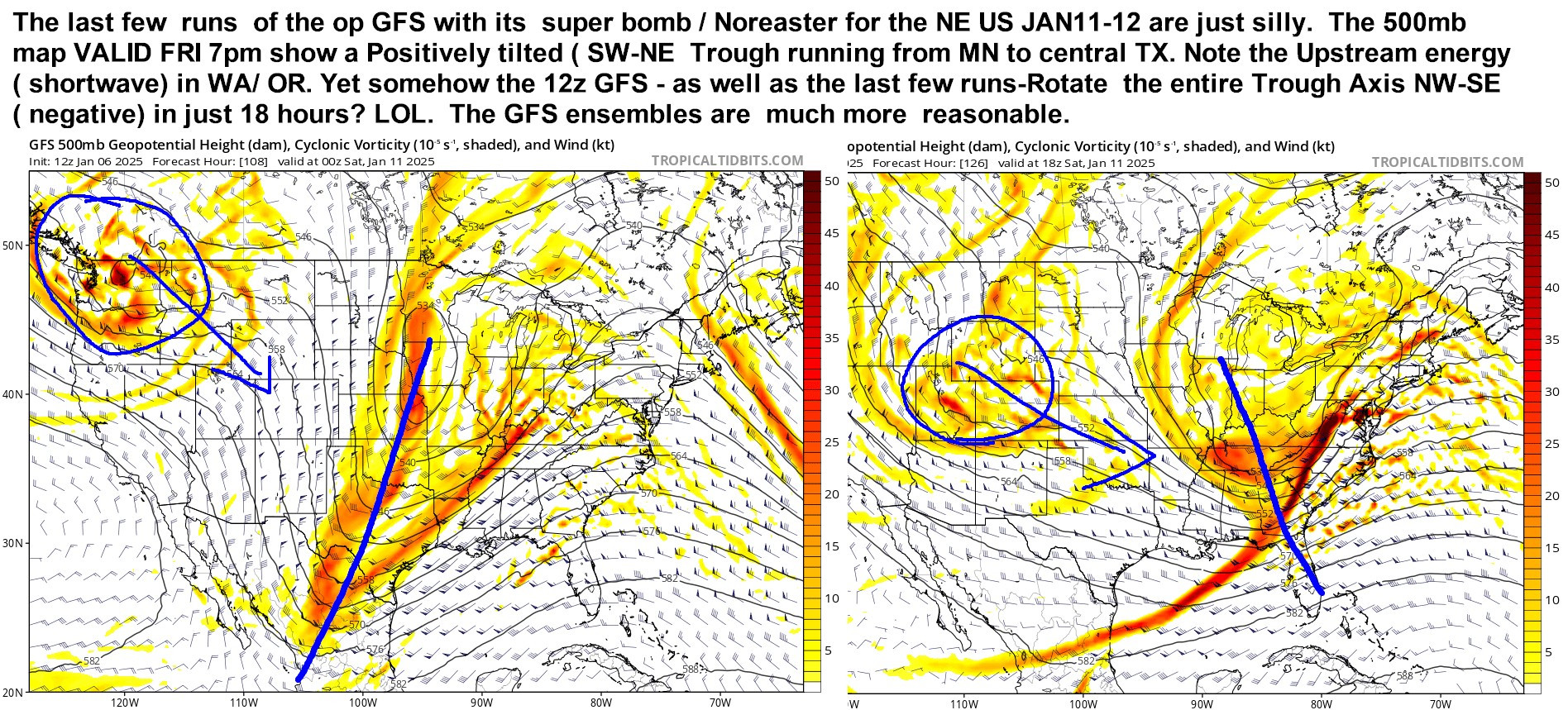
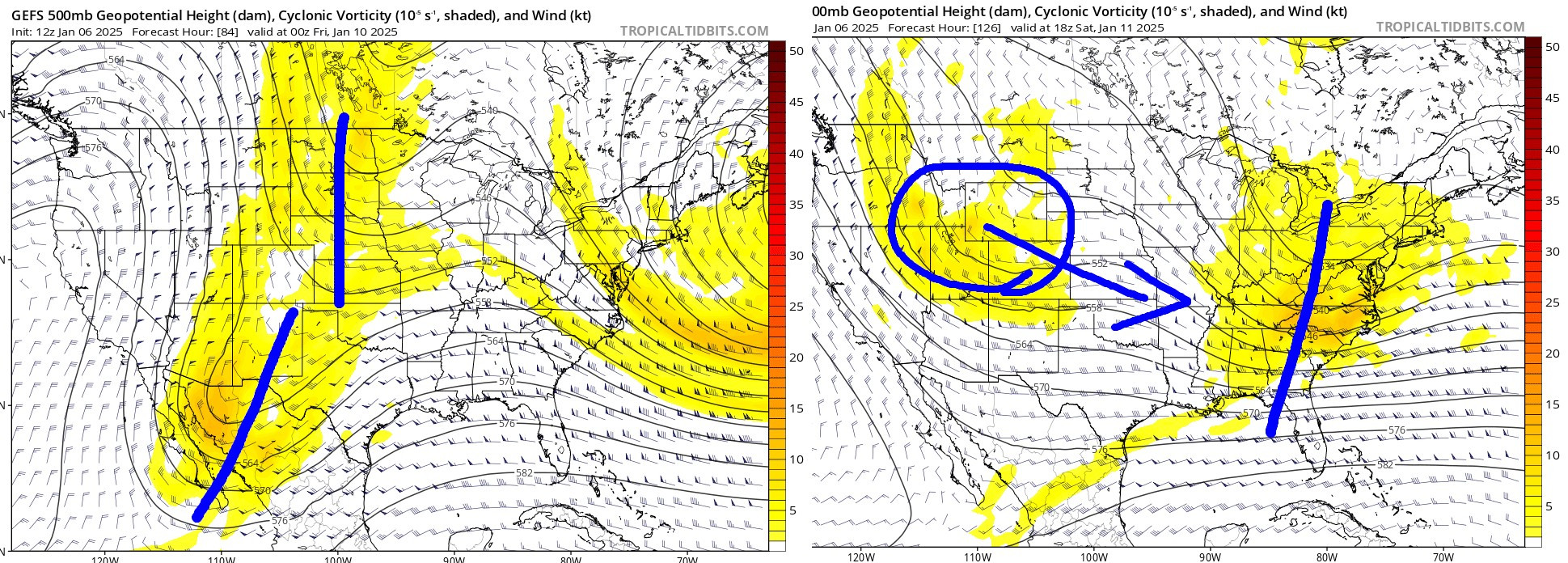
ABOUT JAN 10-11 EAST COAST WINTER STORM THREAT /1
The last few runs of Op-GFS runs look absurd. SEE IMAGE 1. Also whenever operational run of ANY weather model does NOT match its own ensemble - it a clue the op run is crap.
The last few runs of Op-GFS runs look absurd. SEE IMAGE 1. Also whenever operational run of ANY weather model does NOT match its own ensemble - it a clue the op run is crap.
1 / 2
Comments
at this point the preferred idea/ solutions are GGS and Canadian& Euro ensemble means which look VERY good for eastern NC/eastern VA INLCUDING HAMPTON ROADS/ Delmarva / south NJ snowstorm.
Do the math.
if the model shows 0.68" Liquid for a location that is something like 6-8" of snow. etc
I am NOT saying 0.0" snow for I-95 DC- BOST -- just not a MASSIVE system. There is HUGE gap between 2 feet of snow and 0.0"
me but the run was giving me anxiety, i don’t want 30 inch’s , today was fine !!