
🤔 What if embedding multimodal EO data was as easy as using a ResNet on images?
Introducing AnySat: one model for any resolution (0.2m–250m), scale (0.3–2600 hectares), and modalities (choose from 11 sensors & time series)!
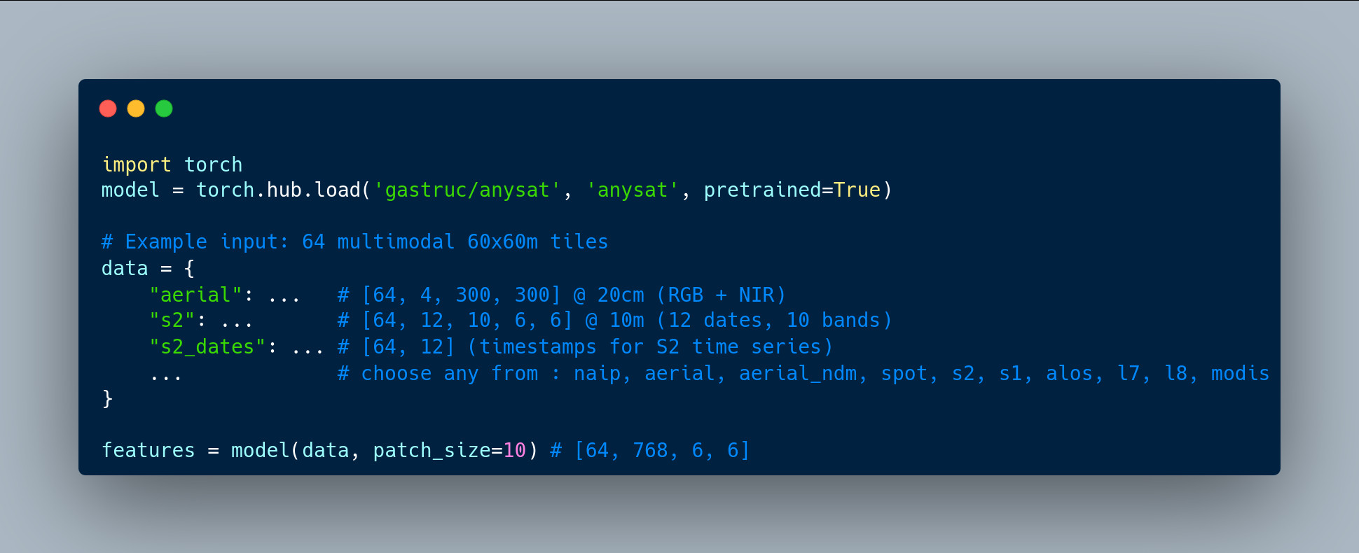
Try it with just a few lines of code:
Introducing AnySat: one model for any resolution (0.2m–250m), scale (0.3–2600 hectares), and modalities (choose from 11 sensors & time series)!
Try it with just a few lines of code:
Comments
🧠 75% of its parameters are shared across all inputs, enabling unmatched flexibility.
📡 11 distinct sensors
📏 Resolutions: 0.2m–500m
🔁 Revisit: single date to weekly
🏞️ Scales: 0.3–150 hectares
The pretrained model can adapt to truly diverse data, and probably yours too!
🌱 Land cover mapping
🌾 Crop type segmentation
🌳 Tree species classification
🌊 Flood detection
🌍 Change detection
That means you can fine-tune just a few thousand parameters and achieve SOTA results on challenging tasks—all with minimal effort.
📜 Paper: https://arxiv.org/abs/2412.14123
🌐 Project: https://gastruc.github.io/anysat
🤗 HuggingFace: https://huggingface.co/g-astruc/AnySat
🐙 GitHub: https://github.com/gastruc/AnySat