In the Plains, we'd see that and think about cold pools, stabilization, etc. What separates the types of events? Trop cyclones and many SE US events can support supercells embedded in a mess of rain, but we don't see, at least in my experience (anecdotes != good data), it very often in the Plains.
The closest I can think of in the Plains is the Happy, TX supercell on 3/13/21, which was ingesting anvil precip from a supercell to its south as it produced a tornado. But that was nowhere near as extensive as this. Definitely makes me want to look at soundings for some of these events...
May 24, 2011 Canton Lake (OK) tornado was raging while sucking in forward flank precip from a closely spaced cell to its south. May 10, 2010 also a great example of overlapping supercells with substantial tornadoes embedded in precip from neighboring cells. I’m fascinated by this behavior.
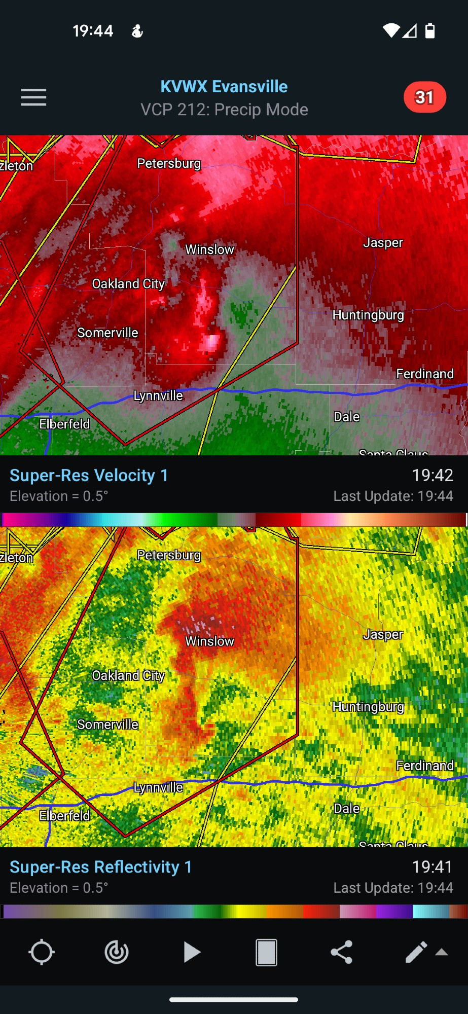
It would appear to be getting at least mildly nudged by that stuff near the hook (green circle), but that stuff in the forward flank reminds me of the junk we found to be associated with non-tor cases. Sure enough iirc, didn't this cell barely manage this tor for a few minutes?
Comments