This also greatly understates it because it doesn't account for how much of the not-interchange use around the interchange is low value low density crap because of the interchange.
How many ppl would you estimate is in that? How many potential businesses and revenue generated? I'd love to have some sorta estimator where you draw an outline and say replace with x city like Paris, Munich, Barcelona etc...see ppl, # biz and revenue generated from biz and tax v a road
From the left (facing traffic):
- bus / taxi
- any vehicle
- any vehicle
- any vehicle
- any vehicle
- Divider. Used for public services (trash, taxi stops, parking, etc), but mainly to avoid cars in the bike lane.
- bike only
I was curious so I grabbed a couple of screenshots of what it looks like currently. It’s all just grass under the interchange, they’re doing literally nothing else with the space. It doesn’t even look like native grasses.
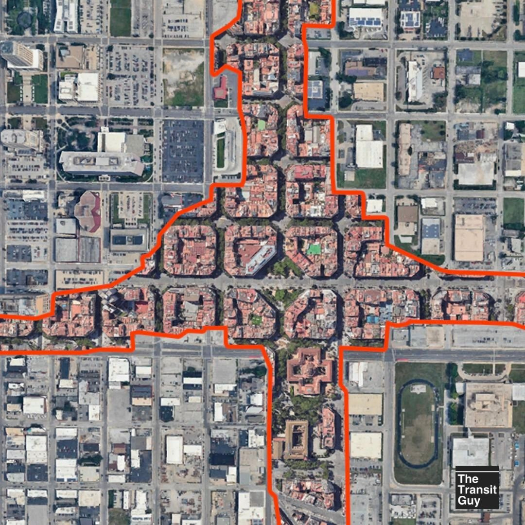
Coords for anyone else who’s curious: 39.09671° N, 94.57214° W
Comments
https://maps.app.goo.gl/CFbQVsLhx1TcLvyB7
- bus / taxi
- any vehicle
- any vehicle
- any vehicle
- any vehicle
- Divider. Used for public services (trash, taxi stops, parking, etc), but mainly to avoid cars in the bike lane.
- bike only
Coords for anyone else who’s curious: 39.09671° N, 94.57214° W