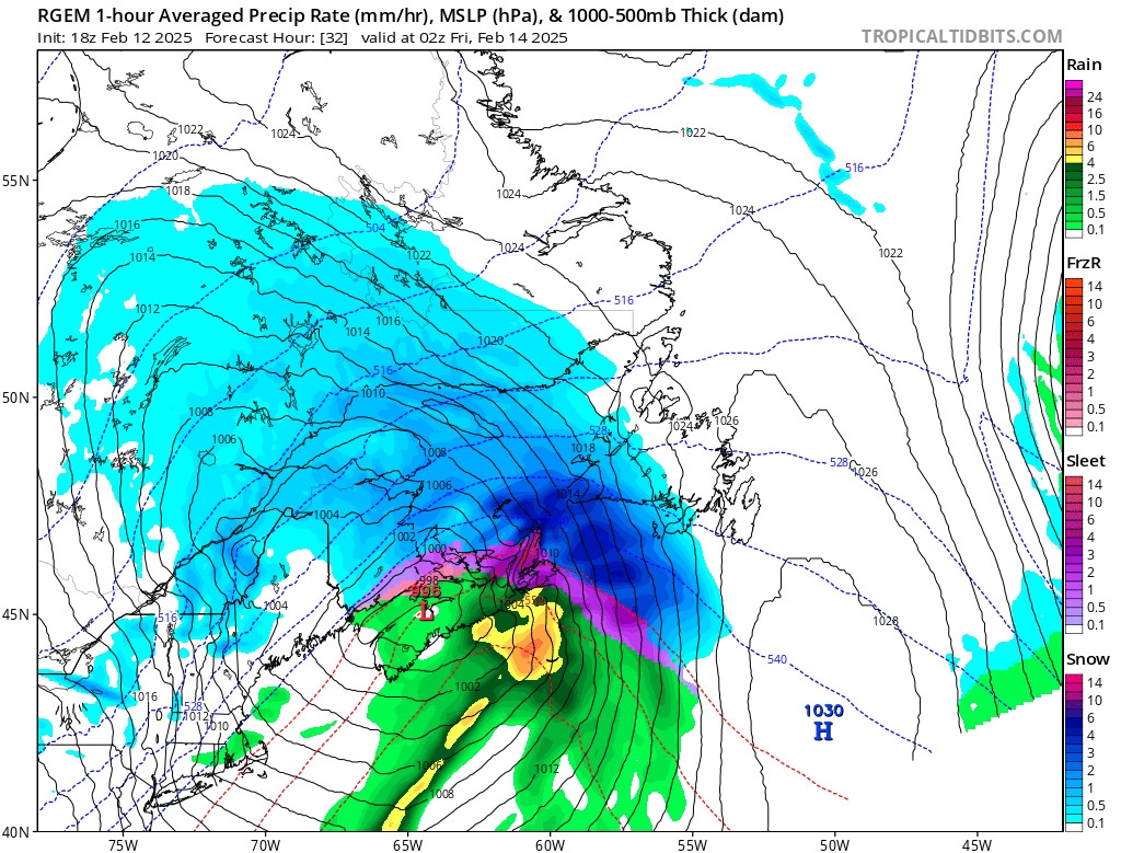
1. Our next #NLwx system rolls in Thursday night into Friday.
Precipitation will be primarily snow. However, parts of eastern Nfld will see snow chg to ice pellets, freezing rain & drizzle on Friday AM before changing back to flurries Friday afternoon.
Snow tapers to flurries for Nfld Friday.
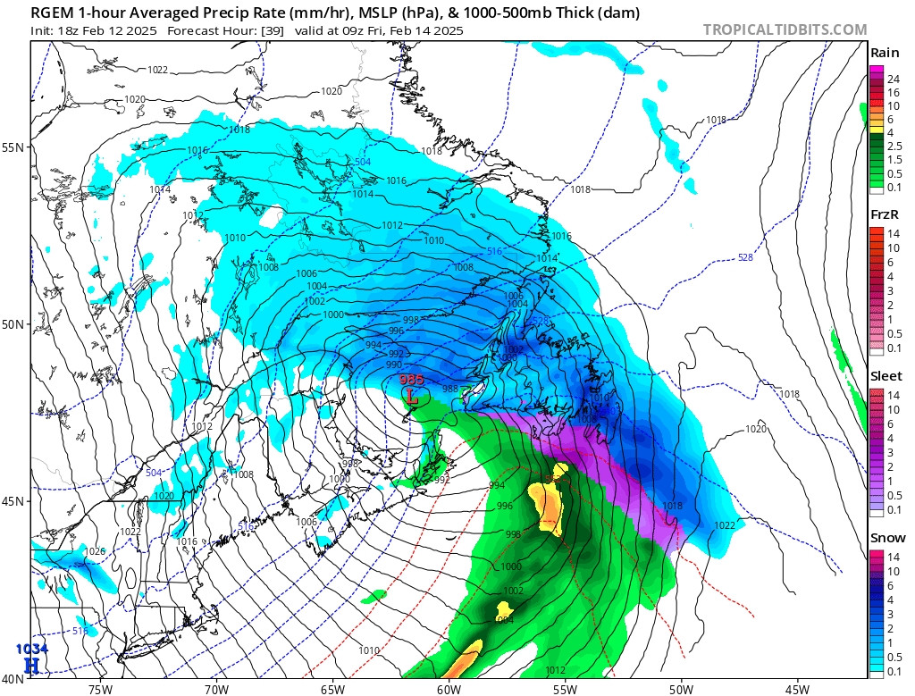
Precipitation will be primarily snow. However, parts of eastern Nfld will see snow chg to ice pellets, freezing rain & drizzle on Friday AM before changing back to flurries Friday afternoon.
Snow tapers to flurries for Nfld Friday.
1 / 4
Comments
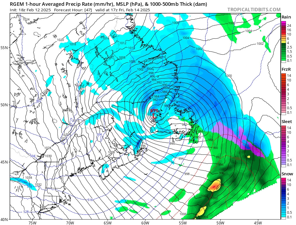
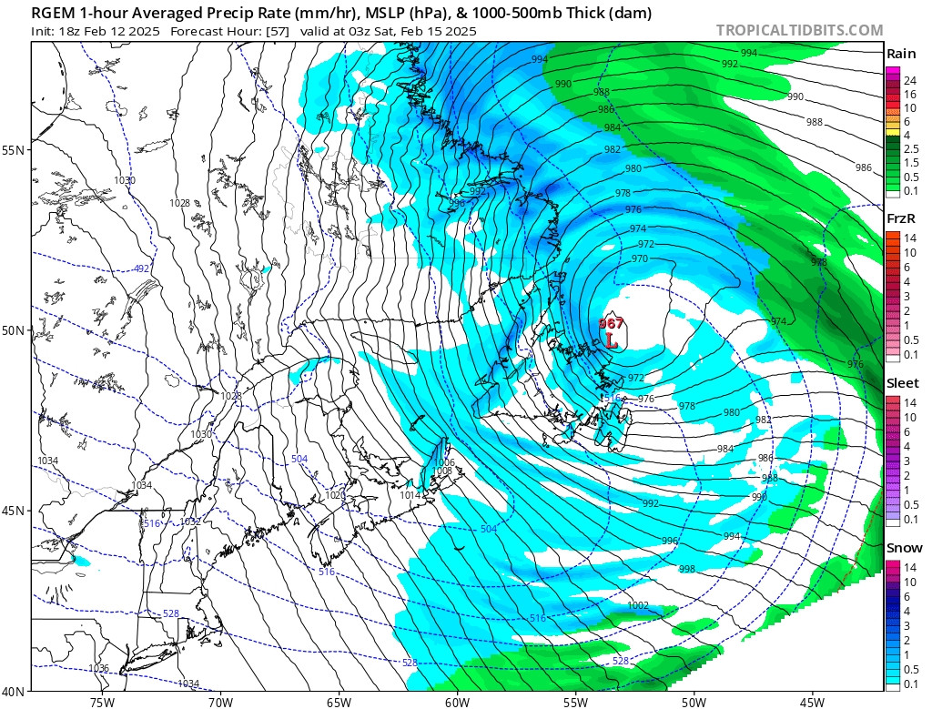
As the low sits east of the island over the weekend, many parts of Nfld will be see periods of snow & flurries w/snow squalls for western Nfld.
Wind gusts will be 70-100+ km/h making for blowing snow
#nlwx
Eastern half & parts of central Nfld: 10-20cm.
SW, western & southern Nfld, GNP, Baie Verte Peninsula, parts of central & Bay of Exploits: 15-25cm.
#NLwx
30-50cm+ for the Labrador coast, except 15-30cm for the Labrador Straits.
Eagle River, Cartwright Jct, HVGB: 20-35cm.
#NLwx