srhelicity.bsky.social
Meteorologist (B.S., M.S., Ph.D.).
All views my own
214 posts
1,377 followers
648 following
Regular Contributor
Active Commenter
comment in response to
post
I should have mentioned that the CC and Z *could* be biological (tho typically see more azmthl varblty in CC and ZDR in bio), but velocity (everywhere closer to 0, much less than the wind) & SW (also v low, indicating little variability in velocities in radar volumes) hints at ground/sea clutter
comment in response to
post
Is Conrad in this pic?
comment in response to
post
Just to be clear (heh!), here's the current visible satellite imagery showing just some cirrus and maybe some altocumulus over the northwestern Gulf. Our standard dual-pol products (e.g., correlation coefficient) show that these are all non-meteorological echoes as well.
comment in response to
post
Can see the tremendous inversion on the CRP and, to a little less extent, LCH soundings this morning. I wonder if the additional "rings" farther out are 2nd & 3rd hit of the ocean after EM forward scatters off ocean sfc once, then gets bent and hits sfc again a 2nd time. Prop path like (Radar)/\x/\x
comment in response to
post
🎶 where the watermelons grow...🎶
(Doesn't have the same ring to it)
comment in response to
post
comment in response to
post
Tell Gemini or whatever to put that reflectivity image on the back of an old minivan a la the stick-figure family stickers
comment in response to
post
comment in response to
post
I suspect the phase 2 Agency Reorg and RIF Plan (ARRP), which is due next week, mirrors this budget request or at least is consistent with it. They wouldn't go through reorg and RIF if the plan is to cut the budget like this in 6 months. I read this as a tell for what DOC's ARRP is, in which case...
comment in response to
post
Rorschach test...
comment in response to
post
I imagine it's hard to free staff when flood and severe warning operations continue today and through the next several days, and the ensuing cleanup efforts make assessments that follow days/weeks later harder I'd think.
comment in response to
post
In the Plains, we'd see that and think about cold pools, stabilization, etc. What separates the types of events? Trop cyclones and many SE US events can support supercells embedded in a mess of rain, but we don't see, at least in my experience (anecdotes != good data), it very often in the Plains.
comment in response to
post
I say "since 2018" -- I mean since the same date in 2018 (so 3/28/2018-3/28/2025). This would include the 6/20 (#8) and 9/12 (#6) events that occurred in 2018.
comment in response to
post
The period of record is ~73 years, so the most recent ~7 year period (since early 2018) represents ~10% of the period of record. Despite that, it's interesting that 6 of the top 10 highest daily rainfall amounts have occurred in the past 7 years (since 2018).
comment in response to
post
But which one?
comment in response to
post
🎶🎷🎶
comment in response to
post
Powerman 5000 is so disappointed by this...
comment in response to
post
I'm on Maui now. Any chance it'll get tall enough for me to see if from Lahaina? 🙃
comment in response to
post
Actually meant to post this to clarify the point
comment in response to
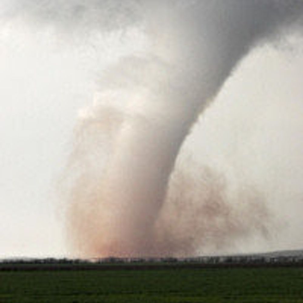
post
Zoomed out and thought "sure, sure, just a damaging tornado associated with a relatively non-descript supercell embedded in a bunch of stratiform rain...
comment in response to
post
Tony has a nice animation of this extremely unfortunate situation bsky.app/profile/tlyz...
comment in response to
post
New MD for this storm
comment in response to
post
Also, I'm still amazed that I can watch things unfold as I ride at ~550 mph westbound near 36k ft over the southwestern US...
comment in response to
post
I mean, this fire outbreak is something else right now ...
comment in response to
post
Meant to include the true color to better illustrate where the dust/dirt is....