
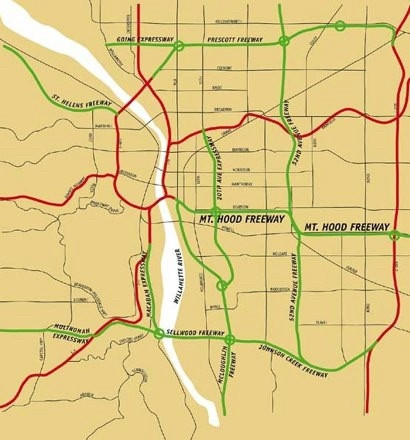
A map of freeways proposed for Portland in the 1950s and 60s. (Red=built, green=proposed). Most US cities have a map like this somewhere. Some of Portland's most distinctive and vibrant neighborhoods would've been destroyed. The wealthiest enclaves would've been protected, of course.
Comments
https://www.youtube.com/watch?v=yUEHWhO_HdY&list=PLfxy4_sBQdxwf909hUFsM59Y0RC_k9fvV&index=2
https://www.freewheeling.info/blog/ringways
Look at the vision vs reality here